咨询与建议

限定检索结果

文献类型

  • 8 篇 期刊文献

馆藏范围

  • 8 篇 电子文献
  • 0 种 纸本馆藏

日期分布

学科分类号

  • 8 篇 工学
    • 4 篇 测绘科学与技术
    • 4 篇 环境科学与工程(可...
    • 3 篇 仪器科学与技术
    • 3 篇 地质资源与地质工...
    • 2 篇 机械工程
    • 1 篇 动力工程及工程热...
    • 1 篇 控制科学与工程
    • 1 篇 城乡规划学
  • 2 篇 农学
    • 2 篇 农业资源与环境
  • 2 篇 艺术学
    • 2 篇 美术学

主题

  • 4 篇 cbers-02
  • 2 篇 surface
  • 2 篇 band
  • 2 篇 ccd
  • 2 篇 calibration
  • 2 篇 the
  • 1 篇 simulating
  • 1 篇 evapotranspirati...
  • 1 篇 spatial
  • 1 篇 cross
  • 1 篇 quantification
  • 1 篇 class.
  • 1 篇 irmss
  • 1 篇 cross-calibratio...
  • 1 篇 cbers
  • 1 篇 thermal
  • 1 篇 时空格局
  • 1 篇 偏振光效应
  • 1 篇 spectral
  • 1 篇 仪器偏振效应

机构

  • 4 篇 institut nationa...
  • 4 篇 graduate univers...
  • 4 篇 state key labora...
  • 4 篇 center for natio...
  • 3 篇 china center for...
  • 1 篇 NOT FOUND
  • 1 篇 华中科技大学
  • 1 篇 NOT FOUND
  • 1 篇 state key labora...
  • 1 篇 有色金属成矿预测...
  • 1 篇 北京大学
  • 1 篇 大地测量与地球动...
  • 1 篇 中国科学院遥感与...
  • 1 篇 陕西师范大学
  • 1 篇 colorado state u...
  • 1 篇 西南大学
  • 1 篇 中国科学院大学
  • 1 篇 青海省自然资源遥...
  • 1 篇 清华大学
  • 1 篇 中国科学院上海技...

作者

  • 2 篇 2. the center fo...
  • 2 篇 3. the center fo...
  • 2 篇 4. institut nati...
  • 2 篇 2. graduate univ...
  • 2 篇 3. institut nati...
  • 2 篇 5. china center ...
  • 1 篇 6. state environ...
  • 1 篇 李志伟
  • 1 篇 李佳
  • 1 篇 郭磊
  • 1 篇 3. graduate univ...
  • 1 篇 4. department of...
  • 1 篇 晏磊
  • 1 篇 6. university of...
  • 1 篇 5. national sate...
  • 1 篇 贺敏
  • 1 篇 辜清
  • 1 篇 4. china center ...
  • 1 篇 顾云杨
  • 1 篇 李晶

语言

  • 5 篇 英文
  • 3 篇 中文
检索条件"作者=GU Xingfa1,2.3,TIAN Guoliang1,2. LI Xiaowen1,2.& GUO Jianning4.1. State Key Laboratory of Remote Sensing Science, Jointly Sponsored by the Institute of Remote Sensing Applications of Chinese Academy of Sciences and beijing normal university, {4. 100101,{2."
8 条 记 录,以下是1-10 订阅
排序:
Estimating surface evapotranspiration using combined MODIS and CBERS-02.data
收藏 引用
science China(Technological sciences) 2005年 第S2期48卷 145-160页
作者: XIN Xiaozhou1,2, liU Qinhuo1, TANG Yong1,3, tian guoliang1, gu xingfa1, li {2.,2, ZHENG Hongsheng4 & CHEN Jiayi4.1. state key laboratory of remote sensing science, institute of remote sensing applications, chinese academy of sciences, beijing 100101, China 2. Research Center for remote sensing and GIS, Department of Geography, beijing {2.} {2.}, beijing 100875, China 3. Graduate {2.} of chinese academy of sciences, beijing 100039, China 4. Department of Atmospheric Physics, Peking {2.}, beijing 100871, China state key {2. of {2. {4. science Institute of Remote Sensing Applications Chinese Academy of Sciences Beijing 100101 China Research Center for remote sensing and GIS Department of Geography Beijing Normal University Beijing 100875 China Graduate university Chinese Academy of Sciences Beijing 100039 China Department of Atmospheric Physics Peking University Beijing 100871 China
Spatial scale error is one of the most serious problems in the estimates of land surface heat fluxes of sensible and latent from satellite-borne data such as MODIS 1km resolution reflectance and emissive data. One of ... 详细信息
来源: 维普期刊数据库 维普期刊数据库 同方期刊数据库 同方期刊数据库 评论
The quantification of remote sensing
收藏 引用
science China(Technological sciences) 2005年 第S2期48卷 1-11页
作者: gu xingfa1,2.3,{2.,2. li xiaowen1,{4., jointly sponsored by the institute of remote sensing applications of chinese academy of sciences and beijing normal university, beijing 100101, China 2. The Center for National Spaceborne Demonstration, beijing 100101, China 3. Institut National de la Recherche Agronomique, Climat Sol Environnement, 84.14.Avignon, France 4. China Center for Resource Satellite Data and Application, beijing 100830, China state key {2. of {2. {4. science Beijing Normal University Chinese Academy of Sciences Beijing 100101 China Center for National Spaceborne Demonstration Beijing 100101 China Institut National de la Recherche Agronomique Climat Sol Environnement 84914 Avignon France China Center for Resource Satellite Data and Application Beijing 100830 China
The paper firstly defined the remote sensing information quantification, analyzed the necessity of developing remote sensing quantification, fi{4.red out the application {4.idelines requirement, and pointed out the impo... 详细信息
来源: 维普期刊数据库 维普期刊数据库 同方期刊数据库 同方期刊数据库 评论
Radiometric cross-calibration of the CBERS-02.CCD camera with the TERRA MODIS
收藏 引用
science China(Technological sciences) 2005年 第S2期48卷 44-60页
作者: li Xiaoying1,2.3, gu xingfa1,3,4. MIN Xiangjun5, YU Tao1,3, FU Qiaoyan5, ZHANG Yong1,2.3 & li xiaowen1,3 1. state key laboratory of remote sensing science, jointly sponsored by the institute of remote sensing applications of chinese academy of sciences and beijing normal university, beijing {14., China 2. Graduate university of chinese academy of sciences, beijing 100039, China 3. The Center for National Spaceborne Demonstration, beijing {14., China 4. Institut National de la Recherche Agronomique, Climat Sol Environnement, 84.14.Avignon, France 5. China Center for Resource Satellite Data and Application, beijing 100830, China state key {2. of {2. {4. science Beijing Normal University Chinese Academy of Sciences Beijing 100101 China Graduate university Chinese Academy of Sciences Beijing 100039 China Center for National Spaceborne Demonstration Beijing 100101 China Institut National de la Recherche Agronomique Climat Sol Environnement 84914 Avignon France China Center for Resource Satellite Data and Application Beijing 100830 China
For the application of the CCD camera, the most important payload on CBERS-02. the key is to provide long-term stable radiometric calibration coefficients. Although the vicarious calibration had been proved successful... 详细信息
来源: 维普期刊数据库 维普期刊数据库 同方期刊数据库 同方期刊数据库 评论
Absolute radiometric calibration of CBERS-02.IRMSS thermal band
收藏 引用
science China(Technological sciences) 2005年 第S2期48卷 72-90页
作者: ZHANG Yong1,2.3, gu xingfa1,3,4. YU Tao1,3, ZHANG Yuxiang5, CHEN liangfu1,3, li Xiaoying1,2.3, li xiaowen1,3 & HE liming6 1. state key laboratory of remote sensing science,{14., beijing 100101, China 2. Graduate university of chinese academy of sciences, beijing 100039, China 3. The Center for National Spaceborne Demonstration, beijing 100101, China 4. Institut National de la Recherche Agronomique, Climat Sol Environnement, 84.14.Avignon, France 5. National Satellite Meteorological Center, beijing 100081, China 6. state Environmental Protection Administration, beijing 100029, China state key {2. of {2. {4. science Beijing Normal University Chinese Academy of Sciences Beijing 100101 China Graduate university Chinese Academy of Sciences Beijing 100039 China Center for National Spaceborne Demonstration Beijing 100101 China National Satellite Meteorological Center Beijing 100081 China Institut National de la Recherche Agronomique Climat Sol Environnement 84914 Avignon France state Environmental Protection Administration Beijing 100029 China
Based on the laboratory calibration before launch of CBERS-02.IRMSS thermal infrared channel, the onboard blackbody calibration, the radiometric cross- calibration against TERRA MODIS corresponding channel and the in-... 详细信息
来源: 维普期刊数据库 维普期刊数据库 同方期刊数据库 同方期刊数据库 评论
In flight MTF monitoring and compensation for CCD camera on CBERS-02
收藏 引用
science China(Technological sciences) 2005年 第S2期48卷 29-43页
作者: gu xingfa1,2.3, li Xiaoying1,2.4. MIN Xiangjun5, YU Tao1,2. SUN Jijuan5, ZENG Yong1,2.4. XU Hua1,{2. guo Ding2.6 1. {2. key laboratory of remote sensing {14., jointly sponsored by the institute of remote sensing applications of chinese academy of sciences and beijing normal university, beijing {12., China 2. The Center for National Spaceborne Demonstration, beijing {12., China 3. Institut National de la Recherche Agronomique, Climat Sol Environnement, 84.14.Avignon, France 4. Graduate university of {24. academy of sciences, beijing 100039, China 5. China Center for Resource Satellite Data and Application, beijing 100830, China 6. university of Electronic {14. and Technology of China, Chengdu 610054. China state key {2. of {2. {4. science Beijing Normal University Chinese Academy of Sciences Beijing 100101 China Center for National Spaceborne Demonstration Beijing 100101 China Institut National de la Recherche Agronomique Climat Sol Environnement 84914 Avignon France Graduate university Chinese Academy of Sciences Beijing 100039 China China Center for Resource Satellite Data and Application Beijing 100830 China university of Electronic science and Technology of China Chengdu 610054 China
In this article, the approach of simulating ideal tarp scene was proposed to determine the MTF for CCD camera on CBERS-02. The MTF acquired from this technique was compared to those from some common methods. MTFs achi... 详细信息
来源: 维普期刊数据库 维普期刊数据库 同方期刊数据库 同方期刊数据库 评论
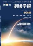
利用InSAR技术估计长江源冰川2.00—2.2.年物质平衡
收藏 引用
测绘学报 2024年 第5期53卷 801-812页
作者: 李佳 李志伟 钟文杰 顾云杨 李龙 郭磊 冯娟娟 中南大学地球科学与信息物理学院 湖南长沙410083 大地测量与地球动力学国家重点实验室 湖北武汉430077 有色金属成矿预测与地质环境监测教育部重点实验室(中南大学) 湖南长沙410083 中南大学地灾感知认知预知研究室 湖南长沙410083 青海省自然资源遥感中心 青海西宁810001
本文以获取近2.年长江源冰川物质平衡,揭示冰川物质平衡影响因素及冰川物质流失对河流径流量影响为目标开展研究。利用InSAR技术和双站TerraSAR-X/TanDEM-X影像生成两期覆盖长江源全域冰川的DEM,分别和SRTM DEM差分,去除高程差系统误差... 详细信息
来源: 维普期刊数据库 维普期刊数据库 同方期刊数据库 同方期刊数据库 博看期刊 评论
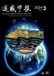
高分辨率定量遥感的偏振光效应与偏振遥感新领域
收藏 引用
遥感学报 2018年 第6期22卷 901-916页
作者: 晏磊 顾行发 褚君浩 尤政 刘世元 Hugh Motimor V.Chandrasekar 北京大学地球与空间科学学院遥感与地理信息系统研究所、空间信息集成与3S工程应用北京市重点实验室 北京100871 中国科学院遥感与数字地球研究所 北京100101 中国科学院上海技术物理研究所 上海200083 清华大学精密仪器系 北京100084 华中科技大学数字制造装备与技术国家重点实验室 武汉430074 Rutherford Appleton laboratory Space Science and Technologies Facilities Counci Colorado state university Fort CollinsColorado 80523
随着航空航天高分辨率观测手段的逐步成熟,定量遥感在有效解决了光学地表多尺度效应后,更高分辨率的光学偏振效应在地表、大气、仪器3大要素方面逐步全面凸显出来,并直接决定或影响高分辨率观测系统的定量遥感效能实现和质量保障。例如... 详细信息
来源: 维普期刊数据库 维普期刊数据库 同方期刊数据库 同方期刊数据库 评论
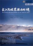
基于土地利用的三峡库区生态系统服务价值时空格局分析
收藏 引用
长江流域资源与环境 2020年 第1期29卷 90-100页
作者: 王大菊 卫海燕 贺敏 辜清 马明国 李晶 陕西师范大学地理科学与旅游学院 陕西西安710119 中国科学院大学 中国科学院遥感科学国家重点实验室北京100101 西南大学地理科学学院 重庆400715
生态服务价值评估是对生态功能的一种经济性量化评价。以三峡库区为研究区,结合净初级生产力(NPP)、土地利用/土地覆盖变化(LUCC)、遥感(RS)、气候、国家统计数据和GIS技术,采用替代花费法、影子工程法、碳税法、市场价值法和水量平衡... 详细信息
来源: 维普期刊数据库 维普期刊数据库 同方期刊数据库 同方期刊数据库 评论