咨询与建议

限定检索结果

文献类型

  • 41 篇 期刊文献
  • 3 篇 会议

馆藏范围

  • 44 篇 电子文献
  • 0 种 纸本馆藏

日期分布

学科分类号

  • 38 篇 工学
    • 10 篇 信息与通信工程
    • 9 篇 计算机科学与技术...
    • 9 篇 城乡规划学
    • 8 篇 测绘科学与技术
    • 8 篇 地质资源与地质工...
    • 8 篇 环境科学与工程(可...
    • 7 篇 仪器科学与技术
    • 6 篇 控制科学与工程
    • 6 篇 建筑学
    • 6 篇 农业工程
    • 5 篇 水利工程
    • 4 篇 材料科学与工程(可...
    • 4 篇 矿业工程
    • 3 篇 航空宇航科学与技...
  • 28 篇 理学
    • 12 篇 地球物理学
    • 10 篇 生态学
    • 7 篇 地理学
    • 6 篇 天文学
    • 5 篇 生物学
    • 4 篇 海洋科学
    • 4 篇 地质学
    • 3 篇 数学
    • 3 篇 大气科学
    • 2 篇 化学
    • 2 篇 统计学(可授理学、...
  • 15 篇 农学
    • 9 篇 农业资源与环境
    • 3 篇 作物学
    • 3 篇 林学
  • 8 篇 管理学
    • 7 篇 公共管理
  • 3 篇 法学
    • 3 篇 社会学
  • 1 篇 经济学

主题

  • 7 篇 remote sensing
  • 4 篇 land
  • 3 篇 china
  • 2 篇 urban expansion
  • 2 篇 urbanization
  • 2 篇 gis
  • 2 篇 modis
  • 2 篇 urban
  • 1 篇 cropland quality
  • 1 篇 coastal ocean
  • 1 篇 classification m...
  • 1 篇 highquality deve...
  • 1 篇 urban ecosystem ...
  • 1 篇 urban undergroun...
  • 1 篇 support vector m...
  • 1 篇 cultural heritag...
  • 1 篇 scenario simulat...
  • 1 篇 deep learning
  • 1 篇 multi-temporal i...
  • 1 篇 remote sensing i...

机构

  • 4 篇 state key labora...
  • 3 篇 state key labora...
  • 2 篇 university of ch...
  • 2 篇 school of survey...
  • 2 篇 school of survey...
  • 2 篇 school of remote...
  • 2 篇 school of survey...
  • 2 篇 college of resou...
  • 1 篇 department of in...
  • 1 篇 geomatics engine...
  • 1 篇 college of natur...
  • 1 篇 hubei provincial...
  • 1 篇 meteorological o...
  • 1 篇 institute of bot...
  • 1 篇 jiangsu provinci...
  • 1 篇 school of civil ...
  • 1 篇 department of pr...
  • 1 篇 state key labora...
  • 1 篇 national-local j...
  • 1 篇 research center ...

作者

  • 5 篇 xin huang
  • 3 篇 peijun du
  • 3 篇 zhang hebing
  • 2 篇 pei liu
  • 2 篇 jianya gong
  • 2 篇 tao he
  • 2 篇 wang shidong
  • 2 篇 jiayi li
  • 1 篇 zhao yong-hua
  • 1 篇 ruimei han
  • 1 篇 xiangyun wan
  • 1 篇 xia yuanping
  • 1 篇 poonam thapa
  • 1 篇 ling zhang
  • 1 篇 zhang ting-yu
  • 1 篇 pan xiao-fei
  • 1 篇 zhongshi he
  • 1 篇 liguo zhang
  • 1 篇 zhiping chen
  • 1 篇 yiping liu

语言

  • 44 篇 英文
检索条件"机构=Shangdong Provincial Institute of Land Surveying and Mapping"
44 条 记 录,以下是1-10 订阅
排序:
Characterizing extreme drought and wetness in Guangdong,China using global navigation satellite system and precipitation data
收藏 引用
Satellite Navigation 2024年 第1期5卷 258-274页
作者: Hai Zhu Kejie Chen Haishan Chai Yuanbin Ye Wenjian Liu Department of Earth and Space Sciences Southern University of Science and TechnologyShenzhen518055China lands and Resource Department of Guangdong Province Surveying and Mapping InstituteGuangzhou510500China
As global temperature rises,the frequency of extreme climate events,e.g.,severe droughts and floods,has increased significantly and caused severe damage over the past *** this regard,precipitation efficiency,a crucial... 详细信息
来源: 维普期刊数据库 维普期刊数据库 评论
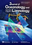
Neomicrocoleus ***.(Microcoleaceae,Oscillatoriales),a novel cyanobacterial genus from benthic mats in a water channel
收藏 引用
Journal of Oceanology and Limnology 2024年 第1期42卷 263-276页
作者: Ruozhen GENG Zhongshi HE Kaihui GAO Peng XIAO He ZHANG Si CHEN Hua LI Gongliang YU Renhui LI College of Life and Environmental Sciences Wenzhou UniversityWenzhou 325035China Key Laboratory of Algal Biology Institute of HydrobiologyChinese Academy of SciencesWuhan 430072China University of Chinese Academy of Sciences Beijing 100049China Hubei Institution of land surveying and mapping Wuhan 430072China
A new filamentous cyanobacterial strain(CHAB 4127)was successfully isolated from the algal mat during the field investigation of the open channel from Luanhe River to Tianjin,*** polyphasic approach combining morpholo... 详细信息
来源: 维普期刊数据库 维普期刊数据库 同方期刊数据库 同方期刊数据库 评论
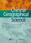
Influence of Human Activity Intensity on Habitat Quality in Hainan Tropical Rainforest National Park,China
收藏 引用
Chinese Geographical Science 2024年 第3期34卷 519-532页
作者: HAN Nianlong YU Miao JIA Peihong ZHANG Yucheng HU Ke School of Geography and Tourism Huizhou UniversityHuizhou 516007China School of Public Administration Hainan Uni-versityHaikou 570228China Department of land surveying and Geo-Informatics The Hong Kong Polytechnic UniversityHong KongChina School of Geographic Sciences and Remote Sensing Guangzhou UniversityGuangzhou 510006China School of Public Administration Nanjing Agricultural UniversityNanjing 210095China
Due to long-term human activity interference,the Hainan Tropical Rainforest National Park(HTRNP)of China has experienced ecological problems such as habitat fragmentation and biodiversity loss,and with the expanding s... 详细信息
来源: 维普期刊数据库 维普期刊数据库 同方期刊数据库 同方期刊数据库 评论
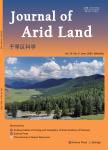
Impact of climate and human activity on NDVI of various vegetation types in the Three-River Source Region, China
收藏 引用
Journal of Arid land 2024年 第8期16卷 1080-1097页
作者: LU Qing KANG Haili ZHANG Fuqing XIA Yuanping YAN Bing Research Center of Resource and Environment Economics East China University of TechnologyNanchang 330013China Jiangxi Key Laboratory of Watershed Ecological Process and Information East China University of TechnologyNanchang 330013China School of surveying and Geoinformation Engineering East China University of TechnologyNanchang 330013China Nanchang Key Laboratory of landscape Process and Territorial Spatial Ecological Restoration East China University of TechnologyNanchang 330013China institute of Energy Research Jiangxi Academy of SciencesNanchang 330096China
The Three-River Source Region(TRSR)in China holds a vital position and exhibits an irreplaceable strategic importance in ecological preservation at the national *** the basis of an in-depth study of the vegetation evo... 详细信息
来源: 维普期刊数据库 维普期刊数据库 同方期刊数据库 同方期刊数据库 评论
A labor-free index-guided semantic segmentation approach for urban vegetation mapping from high-resolution true color imagery
收藏 引用
International Journal of Digital Earth 2023年 第1期16卷 1640-1660页
作者: Peng Zhang Cong Lin Shanchuan Guo Wei Zhang Hong Fang Peijun Du Jiangsu provincial Key Laboratory of Geographic Information Science and Technology Key Laboratory for Land Satellite Remote Sensing Applications of Ministry of Natural ResourcesSchool of Geography and Ocean ScienceNanjing UniversityNanjingPeople’s Republic of China Jiangsu Center for Collaborative Innovation in Geographical Information Resource Development and Application NanjingPeople’s Republic of China c Nanjing Research institute of surveying Mapping&Geotechnical InvestigationCo.LtdNanjingPeople’s Republic of China
Accurate and timely information on urban vegetation(UV)can be used as an important indicator to estimate the health of *** to the low cost of RGB cameras,true color imagery(TCI)has been widely used for high spatial re... 详细信息
来源: 维普期刊数据库 维普期刊数据库 评论
Combined multi-kernel support vector machine and wavelet analysis for hyperspectral remote sensing image classification
收藏 引用
Chinese Optics Letters 2011年 第1期9卷 45-48页
作者: 谭琨 杜培军 Key Laboratory for land Environment and Disaster Monitoring of State Bureau of surveying and mapping of China China University of Mining and Technology
Many remote sensing image classifiers are limited in their ability to combine spectral features with spatial features. Multi-kernel classifiers, however, are capable of integrating spectral features with spatial or st... 详细信息
来源: 维普期刊数据库 维普期刊数据库 同方期刊数据库 同方期刊数据库 评论
Urban Expansion in Major Grain Producing Area from 1978 to 2017:A Case Study of Zhengzhou Metropolitan Area,China
收藏 引用
Chinese Geographical Science 2023年 第1期33卷 1-20页
作者: YANG Yongju ZHANG Hebing QIAO Xuning LIU Liang ZHENG Jinchan School of surveying and land Information Engineering Henan Polytechnic UniversityJiaozuo 454003China Research Centre of Arable land Protection and Urban-rural High-quality Development of Yellow River Basin Henan Polytechnic UniversityJiaozuo 454003China
The spatial form of urbanization in China has developed from single-core city expansion to a multi-center metropolitan ***,little attention has been paid to the growth process of the emerging metropolitan area situate... 详细信息
来源: 维普期刊数据库 维普期刊数据库 同方期刊数据库 同方期刊数据库 评论
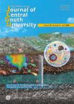
Properties of L-band differential InSAR for monitoring mining-induced subsidence in coalfield of Jining, Northern China
收藏 引用
Journal of Central South University 2014年 第4期21卷 1508-1517页
作者: 陶秋香 刘国林 Geomatics College Shandong University of Science and Technology Key Laboratory of surveying and mapping Technology on Island and Reef of National Administration of surveying mapping and Geoinformation
The properties and feasibility of L-band differential InSAR for detecting and monitoring mining-induced subsidence were systematically analyzed and demonstrated. The largest monitored subsidence gradient of 7.9×10⁻³ ... 详细信息
来源: 维普期刊数据库 维普期刊数据库 同方期刊数据库 同方期刊数据库 评论
GIS-based landslide susceptibility mapping using hybrid integration approaches of fractal dimension with index of entropy and support vector machine
收藏 引用
Journal of Mountain Science 2019年 第6期16卷 1275-1293页
作者: ZHANG Ting-yu HAN Ling ZHANG Heng ZHAO Yong-hua LI Xi-an ZHAO Lei School of Earth Science and Resources Chang’an UniversityKey Laboratory of Degraded and Unutilized Land Remediation EngineeringMinistry of Land and ResourcesShaanxi Provincial Key Laboratory of Land RehabilitationXi’an 710064China School of Geological and surveying&mapping Engineering Chang’an UniversityXi’an 710064China Shaanxi provincial land Engineering Construction Group Xi’an 710075China College of Geology&Environment Xi’an University of Science and TechnologyXi’an 710054China
The loess area in the northern part of Baoji City, Shaanxi Province, China is a region with frequently landslide occurrences. The main aim of this study is to quantitatively predict the extent of landslides using the ... 详细信息
来源: 维普期刊数据库 维普期刊数据库 同方期刊数据库 同方期刊数据库 评论
Chinese Cropland Quality and Its Temporal and Spatial Changes due to Urbanization in 2000–2015
收藏 引用
Journal of Resources and Ecology 2019年 第2期10卷 174-183页
作者: WANG Chunyu SUN Xiaofang WANG Meng WANG Junbang DING Qingfu College of Geography and Tourism Qufu Nonnal University Rizhao Shandong 276826 China Key Laboratory of Ecosystem Network Observation and Modeling Institute of Geographic Sciences and Natural Resources Research Chinese Academy of Sciences Beijing 100101 China shangdong provincial institute of land surveying and mapping Jinan 250013 China
The acceleration of urbanization has led to the occupation of more cropland, especially higher quality cropland, which could pose a huge threat to food security and have other implications for the inadequate cropland ... 详细信息
来源: 维普期刊数据库 维普期刊数据库 同方期刊数据库 同方期刊数据库 评论