咨询与建议

限定检索结果

文献类型

  • 3,930 篇 期刊文献
  • 110 篇 会议

馆藏范围

  • 4,040 篇 电子文献
  • 0 种 纸本馆藏

日期分布

学科分类号

  • 3,016 篇 工学
    • 957 篇 计算机科学与技术...
    • 781 篇 测绘科学与技术
    • 619 篇 控制科学与工程
    • 602 篇 环境科学与工程(可...
    • 551 篇 地质资源与地质工...
    • 490 篇 材料科学与工程(可...
    • 445 篇 城乡规划学
    • 425 篇 建筑学
    • 395 篇 软件工程
    • 385 篇 电子科学与技术(可...
    • 385 篇 信息与通信工程
    • 380 篇 水利工程
    • 331 篇 航空宇航科学与技...
    • 298 篇 仪器科学与技术
    • 284 篇 机械工程
    • 265 篇 电气工程
  • 2,936 篇 理学
    • 1,180 篇 地球物理学
    • 815 篇 天文学
    • 602 篇 大气科学
    • 587 篇 地理学
    • 577 篇 地质学
    • 517 篇 生物学
    • 417 篇 物理学
    • 369 篇 生态学
    • 368 篇 海洋科学
    • 211 篇 化学
  • 888 篇 农学
    • 484 篇 农业资源与环境
    • 282 篇 作物学
  • 419 篇 医学
    • 332 篇 临床医学
  • 380 篇 法学
    • 373 篇 社会学
  • 249 篇 管理学
  • 121 篇 经济学
  • 29 篇 教育学
  • 20 篇 文学
  • 20 篇 艺术学
  • 6 篇 历史学
  • 3 篇 军事学

主题

  • 212 篇 remote sensing
  • 116 篇 remote
  • 103 篇 gis
  • 91 篇 sensing
  • 63 篇 china
  • 58 篇 modis
  • 55 篇 landsat
  • 49 篇 中国
  • 45 篇 model
  • 41 篇 image
  • 41 篇 sar
  • 38 篇 and
  • 37 篇 climate change
  • 34 篇 spatial
  • 34 篇 surface
  • 34 篇 soil
  • 32 篇 temperature
  • 32 篇 of
  • 31 篇 地理信息系统
  • 30 篇 analysis

机构

  • 110 篇 university of ch...
  • 69 篇 state key labora...
  • 66 篇 state key labora...
  • 56 篇 state key labora...
  • 41 篇 university of ch...
  • 38 篇 institute of rem...
  • 33 篇 state key labora...
  • 33 篇 school of remote...
  • 29 篇 school of remote...
  • 26 篇 center for envir...
  • 25 篇 institute of rem...
  • 24 篇 university of ch...
  • 22 篇 state key labora...
  • 22 篇 state key labora...
  • 20 篇 graduate univers...
  • 20 篇 key laboratory o...
  • 19 篇 university of ch...
  • 19 篇 school of remote...
  • 18 篇 school of remote...
  • 18 篇 institute of rem...

作者

  • 35 篇 huadong guo
  • 20 篇 deren li
  • 20 篇 li deren
  • 20 篇 李小文
  • 19 篇 ryutaro tateishi
  • 16 篇 gong jianya
  • 16 篇 lei wang
  • 16 篇 xiao cheng
  • 14 篇 xin huang
  • 14 篇 王锦地
  • 14 篇 shunlin liang
  • 13 篇 zhenfeng shao
  • 13 篇 jianya gong
  • 13 篇 gong peng
  • 12 篇 xin li
  • 12 篇 shen wenbin
  • 12 篇 fei li
  • 11 篇 jing wang
  • 11 篇 hui lin
  • 11 篇 jean-pierre barr...

语言

  • 3,771 篇 英文
  • 269 篇 中文
检索条件"机构=Canada Centre for Remote Sensing"
4040 条 记 录,以下是1-10 订阅
排序:
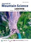
Performance validation of High Mountain Asia 8-meter Digital Elevation Model using ICESat-2 geolocated photons
收藏 引用
Journal of Mountain Science 2024年 第8期21卷 2562-2578页
作者: Giribabu DANDABATHULA Subham ROY Omkar Shashikant GHATAGE Vaibhav Balaso KOLASE Shwetambari SATPUTE Koushik GHOSH Sahibnoor KAUR Satyanarayana PONDARI Apurba Kumar BERA Sushil Kumar SRIVASTAV Regional remote sensing centre-West National Remote Sensing CentreIndian Space Research OrganisationJodhpur 342005India Department of Geography School of Earth SciencesBharathidasan UniversityTiruchirappalli 620024India centre for Climate Change and Water Research Suresh Gyan Vihar UniversityJaipur 302017India Department of Geography Panjab UniversityChandigarh 160014India National remote sensing centre Indian Space Research OrganisationHyderabad 500037India Regional centres National Remote Sensing CentreIndian Space Research OrganisationNew Delhi 110049India
High Mountain Asia(HMA),recognized as a third pole,needs regular and intense studies as it is susceptible to climate *** accurate and high-resolution Digital Elevation Model(DEM)for this region enables us to analyze i... 详细信息
来源: 维普期刊数据库 维普期刊数据库 同方期刊数据库 同方期刊数据库 评论
Exploring diurnal and seasonal variabilities in surface urban heat island intensity in the Guangdong-Hong Kong-Macao Greater Bay Area
收藏 引用
Journal of Geographical Sciences 2024年 第8期34卷 1472-1492页
作者: XU Xianjiong WU Yaowei LIN Gangte GONG Jianzhou CHEN Kanglin School of Geography and remote sensing Guangzhou UniversityGuangzhou 510006China
The urban heat island(UHl)is an environmental problem of wide concern because it poses a threat to both the human living environment and the sustainable development of *** of the spatiotemporal characteristics and the... 详细信息
来源: 维普期刊数据库 维普期刊数据库 评论
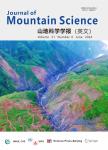
Spatiotemporal changes in sunshine duration and its influential factors in Chongqing,China from 1961 to 2020
收藏 引用
Journal of Mountain Science 2024年 第6期21卷 2005-2024页
作者: LI Jun XIA Hongxuan JIANG Jinge XU Weifeng WEN Di XU Junfeng College of Geography and Tourism Chongqing Normal UniversityChongqing 401331China Key Laboratory of GIS Application of Chongqing Chongqing 401331China Chongqing Key Laboratory of Earth Surface Processes and Environmental remote sensing in Three Gorges Reservoir area Chongqing 401331China Institute of remote sensing and Earth Sciences School of Institute of Remote Sensing and Earth SciencesSchool of ScienceHangzhou Normal UniversityHangzhou 311121China
The surface solar radiation in most parts of the world has undergone a phenomenon known as global dimming and brightening,characterized by an initial decrease followed by an *** a result,the sunshine duration(SD)has d... 详细信息
来源: 维普期刊数据库 维普期刊数据库 同方期刊数据库 同方期刊数据库 评论
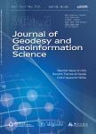
Monitoring Surface Deformation Using Distributed Scatterers InSAR
收藏 引用
Journal of Geodesy and Geoinformation Science 2024年 第1期7卷 42-58页
作者: LI Haocheng DONG Jie WANG Yi’an LIAO Mingsheng State Key Laboratory of Information Engineering in Surveying Mapping and Remote SensingWuhan UniversityWuhan 430079China School of remote sensing and Information Engineering Wuhan UniversityWuhan 430079China
In the past two decades,extensive and in-depth research has been conducted on Time Series InSAR technology with the advancement of high-performance SAR satellites and the accumulation of big SAR *** introduction of di... 详细信息
来源: 维普期刊数据库 维普期刊数据库 评论
Multi-sensor multispectral reconstruction framework based on projection and reconstruction
收藏 引用
Science China(Information Sciences) 2024年 第3期67卷 246-262页
作者: Tianshuai LI Tianzhu LIU Xian LI Yanfeng GU Yukun WANG Yushi CHEN School of Electronics and Information Engineering Harbin Institute of Technology Heilongjiang Province Key Laboratory of Space-Air-Ground Integrated Intelligent remote sensing
The scarcity and low spatial resolution of hyperspectral images(HSIs) have become a major problem limiting the application of the images. In recent years, spectral reconstruction(SR) has been applied to convert multis... 详细信息
来源: 同方期刊数据库 同方期刊数据库 评论
Assessment of spongy moth infestation impacts on forest productivity and carbon loss using the Sentinel-2 satellite remote sensing and eddy covariance flux data
收藏 引用
Ecological Processes 2024年 第2期 231-245页
作者: Nur Hussain Alemu Gonsamo Shusen Wang M.Altaf Arain School of Earth Environment and Society and McMaster Centre for Climate Change Mc Master University canada centre for remote sensing Natural Resources Canada
Background Deciduous forests in eastern North America experienced a widespread and intense spongy moth(Lymantria dispar) infestation in 2021. This study quantified the impact of this spongy moth infestation on carbo...
来源: 同方期刊数据库 同方期刊数据库 评论
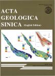
Late Triassic Intracontinental Deformation of South Tianshan,Central Asia:Evidence from Syn-tectonic Sedimentation and Detrital Zircon Provenances of the Kuqa Depression
收藏 引用
Acta Geologica Sinica(English Edition) 2024年 第3期98卷 548-568页
作者: QIN Xiang CHEN Xuanhua SHAO Zhaogang ZHANG Yiping WANG Yongchao LI Bing SU He WANG Ye LIU Kui HAN Lele China Aero Geophysical Survey and remote sensing Center for Natural Resources Beijing 100083China Key Laboratory of Airborne Geophysics and remote sensing Geology MNRBeijing 100083China Chinese Academy of Geological Sciences Beijing 100037China School of Earth Sciences and Resources China University of Geosciences(Beijing)Beijing 100083China
The Tianshan range,a Paleozoic orogenic belt in Central Asia,has undergone multiple phases of tectonic activities characterized by the N-S compression after the early Mesozoic,including the far-field effects of the Ce... 详细信息
来源: 维普期刊数据库 维普期刊数据库 同方期刊数据库 同方期刊数据库 评论
Apatite Fission-Track Thermochronology in the Tamusu Area,Bayingobi Basin,NW China,and its Geological Significance
收藏 引用
Acta Geologica Sinica(English Edition) 2024年 第3期98卷 585-601页
作者: TONG Qinlong QIN Mingkuan YE Fawang CNNC Beijing Research Institute of Uranium Geology National Key Laboratory of Remote Sensing Information and Image Analysis TechnologyBeijing 100029China
The Bayingobi basin is located in the middle of Central Asia Orogenic Belt,at the intersection of Paleo-Asian Ocean and Tethys Ocean,as well as the junction of multiple tectonic *** unique tectonic setting underpins t... 详细信息
来源: 维普期刊数据库 维普期刊数据库 同方期刊数据库 同方期刊数据库 评论
Real-time Rescue Target Detection Based on UAV Imagery for Flood Emergency Response
收藏 引用
Journal of Geodesy and Geoinformation Science 2024年 第1期7卷 74-89页
作者: ZHAO Bofei SUI Haigang ZHU Yihao LIU Chang WANG Wentao State Key Laboratory of Information Engineering in Surveying Mapping and Remote SensingWuhan UniversityWuhan 430079China
Timely acquisition of rescue target information is critical for emergency response after a flood *** Aerial Vehicles(UAVs)equipped with remote sensing capabilities offer distinct advantages,including high-resolution i... 详细信息
来源: 维普期刊数据库 维普期刊数据库 评论
Spatiotemporal changes of gross primary productivity and its response to drought in the Mongolian Plateau under climate change
收藏 引用
Journal of Arid Land 2024年 第1期16卷 46-70页
作者: ZHAO Xuqin LUO Min MENG Fanhao SA Chula BAO Shanhu BAO Yuhai College of Geographical Science Inner Mongolia Normal UniversityHohhot 010022China Inner Mongolia Key Laboratory of remote sensing and Geographic Information Systems Hohhot 010022China
Gross primary productivity(GPP)of vegetation is an important constituent of the terrestrial carbon sinks and is significantly influenced by *** the impact of droughts on different types of vegetation GPP provides insi... 详细信息
来源: 维普期刊数据库 维普期刊数据库 同方期刊数据库 同方期刊数据库 评论