咨询与建议

限定检索结果

文献类型

  • 208 篇 期刊文献
  • 1 篇 会议

馆藏范围

  • 209 篇 电子文献
  • 0 种 纸本馆藏

日期分布

学科分类号

  • 122 篇 工学
    • 26 篇 测绘科学与技术
    • 26 篇 地质资源与地质工...
    • 21 篇 计算机科学与技术...
    • 19 篇 环境科学与工程(可...
    • 18 篇 水利工程
    • 12 篇 城乡规划学
    • 9 篇 农业工程
    • 8 篇 信息与通信工程
    • 7 篇 电子科学与技术(可...
    • 7 篇 控制科学与工程
    • 6 篇 机械工程
    • 6 篇 仪器科学与技术
    • 5 篇 建筑学
    • 5 篇 软件工程
    • 4 篇 航空宇航科学与技...
    • 4 篇 林业工程
  • 78 篇 理学
    • 20 篇 大气科学
    • 14 篇 地理学
    • 14 篇 海洋科学
    • 14 篇 生态学
    • 5 篇 数学
    • 3 篇 地球物理学
  • 35 篇 农学
    • 24 篇 农业资源与环境
    • 8 篇 林学
  • 23 篇 管理学
    • 12 篇 公共管理
    • 7 篇 管理科学与工程(可...
    • 3 篇 工商管理
    • 3 篇 农林经济管理
  • 11 篇 经济学
    • 11 篇 应用经济学
  • 3 篇 文学
    • 2 篇 新闻传播学
  • 2 篇 医学
  • 1 篇 法学
  • 1 篇 历史学

主题

  • 26 篇 remote sensing
  • 13 篇 china
  • 7 篇 modis
  • 7 篇 digital earth
  • 6 篇 google earth eng...
  • 5 篇 validation
  • 4 篇 remote
  • 4 篇 sustainable deve...
  • 4 篇 deep learning
  • 4 篇 sensing
  • 4 篇 land use change
  • 4 篇 albedo
  • 4 篇 satellite remote...
  • 4 篇 land surface tem...
  • 4 篇 climate change
  • 4 篇 landslide
  • 4 篇 assessment
  • 3 篇 random forest
  • 3 篇 heterogeneous
  • 3 篇 arctic

机构

  • 21 篇 university of ch...
  • 15 篇 key laboratory o...
  • 13 篇 university of ch...
  • 12 篇 key laboratory o...
  • 12 篇 state key labora...
  • 11 篇 college of resou...
  • 11 篇 college of resou...
  • 11 篇 international re...
  • 6 篇 institute of rem...
  • 5 篇 satellite enviro...
  • 5 篇 key laboratory o...
  • 4 篇 center for earth...
  • 4 篇 institute of geo...
  • 4 篇 key laboratory o...
  • 4 篇 beijing key labo...
  • 4 篇 state key labora...
  • 3 篇 college of globa...
  • 3 篇 school of remote...
  • 3 篇 state key labora...
  • 3 篇 school of remote...

作者

  • 12 篇 huadong guo
  • 7 篇 peng gong
  • 7 篇 yubao qiu
  • 6 篇 min chen
  • 6 篇 hui lin
  • 5 篇 guang liu
  • 4 篇 xinyuan wang
  • 4 篇 shunlin liang
  • 3 篇 xi chen
  • 3 篇 liu changming
  • 3 篇 kuang wenhui
  • 3 篇 li zhang
  • 3 篇 massimo menenti
  • 3 篇 jianhua gong
  • 3 篇 dailiang peng
  • 3 篇 qing zhang
  • 3 篇 le yu
  • 3 篇 qianfeng wang
  • 3 篇 xuecao li
  • 3 篇 xingxing wang

语言

  • 188 篇 英文
  • 21 篇 中文
检索条件"机构=Beijing Key Laboratory for Remote Sensing of Environment and Digital Cities"
209 条 记 录,以下是1-10 订阅
排序:
Using eye tracking to evaluate the usability of animated maps
收藏 引用
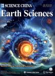
Science China Earth Sciences 2014年 第3期57卷 512-522页
作者: DONG WeiHua LIAO Hua XU Fang LIU Zhao ZHANG ShaoBo State key laboratory of remote sensing Science Beijing Key Laboratory for Remote Sensing of Environment and Digital Cities & School of Geography and Remote Sensing Science Beijing Normal University
Cartographic animation has been developed and widely used in geo-visualisation and many other areas in recent *** usability of animated maps is a key characteristic affecting map users’effectiveness and efficiency in... 详细信息
来源: 维普期刊数据库 维普期刊数据库 同方期刊数据库 同方期刊数据库 评论
Information flow and controlling in regularization inversion of quantitative remote sensing
收藏 引用
Science China Earth Sciences 2005年 第1期48卷 74-83页
作者: YANG Hua, XU Wangli, ZHAO Hongrui, CHEN Xue & WANG Jindi Research Center for remote sensing and GIS, School of Geography, beijing Normal University, State key laboratory of remote sensing Science, beijing key laboratory for remote sensing of environment and digital cities, beijing 100875, China Department of Mathematics, beijing Normal University, beijing 100875, China Research Center for remote sensing and GIS School of Geography Beijing Normal University State Key Laboratory of Remote Sensing Science Beijing Key Laboratory for Remote Sensing of Environment and Digital Cities Beijing China Department of Mathematics Beijing Normal University Beijing China
In order to minimize uncertainty of the inversed parameters to the largest extent by making full use of the limited information in remote sensing data, it is necessary to understand what the information flow in quanti... 详细信息
来源: 维普期刊数据库 维普期刊数据库 同方期刊数据库 同方期刊数据库 评论
Research on scale effect of histogram
收藏 引用
Science China Earth Sciences 2002年 第10期45卷 949-960页
作者: 张颢 李小文 阎广建 焦子锑 王锦地 赵红蕊 杨华 苏理宏 Research Center for remote sensing and GIS Department of Geography and Beijing Key Laboratory for Remote Sensing of Environment and Digital Cities Beijing Normal University Beijing China Center for remote sensing and Department of Geography Boston University USA
To describe the spatial relationship among the earth objects compactly, in this paper, we raised the concept of histo-variogram based on the analysis of the characteristics of other spatial analyzing methods such as v... 详细信息
来源: 维普期刊数据库 维普期刊数据库 同方期刊数据库 同方期刊数据库 评论
Evaluating the generalization ability of convolutional neural networks for built-up area extraction in different cities of China
收藏 引用
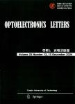
Optoelectronics Letters 2020年 第1期16卷 52-58页
作者: ZHANG Tao TANG Hong State key laboratory of remote sensing Science Jointly Sponsored by Beijing Normal University and Institute of Remote Sensing and Digital Earth of Chinese Academy of SciencesBeijing 100875China beijing key laboratory for remote sensing of environment and digital cities Faculty of Geographical ScienceBeijing Normal UniversityBeijing 100875China
The difficulty of build-up area extraction is due to complexity of remote sensing data in terms of heterogeneous appearance with large intra-class variations and lower inter-class variations. In order to extract the b... 详细信息
来源: 维普期刊数据库 维普期刊数据库 同方期刊数据库 同方期刊数据库 评论
Study on NDVI-T_s space by combining LAI and evapotranspiration
收藏 引用
Science China Earth Sciences 2006年 第7期49卷 747-754页
作者: HAN Lijuan1,2,3, WANG Pengxin4, YANG Hua1,2,3, LIU Shaomin1,2,3 & WANG Jindi1,2,3 1. Research Center for remote sensing and GIS, School of Geography, beijing Normal University, beijing 100875, China 2. State key laboratory of remote sensing Science, beijing 100875, China 3. beijing key laboratory for remote sensing of environment and digital cities, beijing 100875, China 4. Department of Information Management, College of Information and Electronic Engineering, China Agricultural University, beijing 100083, China Research Center for remote sensing and GIS School of Geography Beijing Normal University Beijing China State key laboratory of remote sensing Science Beijing China beijing key laboratory for remote sensing of environment and digital cities Beijing China Department of Information Management College of Information and Electronic Engineering China Agricultural University Beijing China
This paper focuses on interpreting the different spatial relationships between NDVI and Ts, a triangular or a trapezoid, and on analyzing transformation conditions, the physical and ecological meanings of the vegetati... 详细信息
来源: 维普期刊数据库 维普期刊数据库 同方期刊数据库 同方期刊数据库 评论
Thermal bidirectional gap probability model for row crop canopies and validation
收藏 引用
Science China Earth Sciences 2003年 第12期46卷 1241-1249页
作者: 阎广建 蒋玲梅 王锦地 陈良富 李小文 Research Center for remote sensing and GIS Department of Geography and Beijing Key Laboratory for Remote Sensing of Environment and Digital Cities Beijing Normal University Beijing 100875 China LARSIS Institute of Remote Sensing Application Chinese Academy of Sciences Beijing 100101 China Department of Geography and Center for remote sensing Boston University Boston MA 02215 USA
Based on the row structure model of Kimes and the mean gap probability model in single direction, we develop a bidirectional gap probability model for row crop canopies. A concept of overlap index is introduced in thi... 详细信息
来源: 维普期刊数据库 维普期刊数据库 同方期刊数据库 同方期刊数据库 评论
Assessing the uncertainties of phytoplankton absorption-based model estimates of marine net primary productivity
收藏 引用
Acta Oceanologica Sinica 2017年 第6期36卷 112-121页
作者: TAO Zui MA Sheng YANG Xiaofeng WANG Yan State key laboratory of remote sensing Science Institute of Remote Sensing and Digital EarthChinese Academy of SciencesBeijing 100101China beijing North-Star digital remote sensing Technology Co.Ltd. Beijing 100120China State environmental Protection key laboratory of Numerical Modeling for environment Impact Assessment Beijing 100012China
Satellite-derived phytoplankton pigment absorption (aph) has been used as a key predictor of phytoplankton photosynthetic efficiency to estimate global ocean net primary production (NPP). In this study, an aph-bas... 详细信息
来源: 维普期刊数据库 维普期刊数据库 同方期刊数据库 同方期刊数据库 评论
Permafrost environment monitoring on the Qinghai-Tibet Plateau using time series ASAR images
收藏 引用
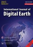
International Journal of digital Earth 2015年 第10期8卷 840-860页
作者: Zhen Li Panpan Tang Jianmin Zhou Bangsen Tian Quan Chen Sitao Fu key laboratory of digital Earth Institute of Remote Sensing and Digital EarthChinese Academy of SciencesBeijingChina Institute of remote sensing and digital Earth University of the Chinese Academy of SciencesBeijingChina
The permafrost in Qinghai-Tibet Plateau(QTP)has long been the focus of many *** this study,we first use the method that integrates synthetic aperture radar(SAR)intensity and phase information to monitor permafrost env... 详细信息
来源: 维普期刊数据库 维普期刊数据库 评论
Development of ecohydrological assessment tool and its application
收藏 引用
Science China(Technological Sciences) 2009年 第7期52卷 1947-1957页
作者: LIU ChangMing YANG ShengTian WEN ZhiQun WANG XueLei WANG YuJuan LI Qian SHENG HaoRan Institude of Water Science Beijing Normal UniversityBeijing 100875China State key laboratory of remote sensing Science Beijing Key Laboratory for Remote Sensing of Environment and Digital CitiesSchool of GeographyBeijing Normal UniversityBeijing 100875China key laboratory of Water Resources and Related Land Surface Processes Institute of Geographical Sciences and Natural ResourcesChinese Academy of SciencesBeijing 100101China
The development of Hydro-Informatic Modelling System (HIMS) provides an integrated platform for hydrological simulation. To extend the application of HIMS, an ecohydrological modeling system named ecohydrological asse... 详细信息
来源: 维普期刊数据库 维普期刊数据库 同方期刊数据库 同方期刊数据库 评论
Synchronous estimation of DTM and fractional vegetation cover in forested area from airborne LIDAR height and intensity data
收藏 引用
Science China(Technological Sciences) 2008年 第S2期51卷 176-187页
作者: BAO YunFei1,2,CAO ChunXiang1,ZHANG Hao1,CHEN ErXue3,HE QiSheng1,2,HUANG HuaBing1,LI ZengYuan3,LI XiaoWen1,4 & GONG Peng1 1 State key laboratory of remote sensing Science,jointly sponsored by the Institute for remote sensing Applications of Chinese Academy of Sciences and beijing Normal University,beijing 100101,China 2 Graduate University of the Chinese Academy of Sciences,beijing 100049,China 3 Institute of Forest Resource Information Technique,the Chinese Academy of Forestry,beijing 100091,China 4 Research Center for remote sensing and GIS,Department of Geography and beijing key laboratory for remote sensing of environment and digital Sites,beijing Normal University,beijing 100875,China State key laboratory of remote sensing Science jointly sponsored by the Institute for Remote Sensing Applications of Chinese Academy of Sciences and Beijing Normal University Beijing China Graduate University of the Chinese Academy of Sciences Beijing China Institute of Forest Resource Information Technique the Chinese Academy of Forestry Beijing China Research Center for remote sensing and GIS Department of Geography and Beijing Key Laboratory for Remote Sensing of Environment and Digital Sites Beijing Normal University Beijing China
We proposed a method to separate ground points and vegetation points from discrete return,small footprint airborne laser scanner data,called skewness change *** method,which makes use of intensity of laser scanner dat... 详细信息
来源: 维普期刊数据库 维普期刊数据库 同方期刊数据库 同方期刊数据库 评论