咨询与建议

限定检索结果

文献类型

  • 217 篇 期刊文献
  • 26 篇 会议

馆藏范围

  • 243 篇 电子文献
  • 0 种 纸本馆藏

日期分布

学科分类号

  • 167 篇 工学
    • 51 篇 环境科学与工程(可...
    • 50 篇 测绘科学与技术
    • 40 篇 地质资源与地质工...
    • 30 篇 农业工程
    • 25 篇 水利工程
    • 19 篇 控制科学与工程
    • 17 篇 仪器科学与技术
    • 14 篇 信息与通信工程
    • 12 篇 计算机科学与技术...
    • 10 篇 机械工程
    • 8 篇 软件工程
    • 6 篇 城乡规划学
    • 5 篇 矿业工程
    • 4 篇 建筑学
    • 4 篇 风景园林学(可授工...
    • 4 篇 安全科学与工程
    • 3 篇 电子科学与技术(可...
    • 3 篇 航空宇航科学与技...
  • 91 篇 农学
    • 58 篇 农业资源与环境
    • 24 篇 林学
    • 5 篇 作物学
    • 4 篇 植物保护
  • 83 篇 理学
    • 34 篇 生态学
    • 22 篇 地理学
    • 11 篇 大气科学
    • 6 篇 地球物理学
    • 4 篇 海洋科学
  • 19 篇 管理学
    • 9 篇 公共管理
    • 7 篇 管理科学与工程(可...
  • 5 篇 医学
  • 4 篇 经济学
    • 3 篇 理论经济学
  • 2 篇 历史学
  • 1 篇 法学

主题

  • 31 篇 gis
  • 19 篇 remote sensing
  • 15 篇 遥感
  • 13 篇 remote
  • 13 篇 sensing
  • 11 篇 地理信息系统
  • 10 篇 rs
  • 9 篇 spatial
  • 7 篇 土壤侵蚀
  • 7 篇 china
  • 7 篇 land
  • 5 篇 model
  • 5 篇 生态环境
  • 5 篇 土地利用
  • 5 篇 data
  • 5 篇 area
  • 4 篇 卫星遥感
  • 4 篇 environment
  • 4 篇 inversion
  • 4 篇 动态变化

机构

  • 16 篇 中国科学院遥感应...
  • 15 篇 北京大学
  • 15 篇 中国科学院大学
  • 12 篇 北京师范大学
  • 8 篇 首都师范大学
  • 6 篇 中国科学院地理科...
  • 5 篇 中国科学院研究生...
  • 5 篇 中国科学院遥感与...
  • 5 篇 清华大学
  • 5 篇 中国科学院地理科...
  • 4 篇 中国科学院寒区旱...
  • 4 篇 南京师范大学
  • 4 篇 中国科学院遥感与...
  • 4 篇 中国地质大学
  • 4 篇 中国农业大学
  • 4 篇 山东农业大学
  • 3 篇 中国科学院水利部...
  • 3 篇 1. state key lab...
  • 3 篇 中国科学院遥感与...
  • 3 篇 武汉大学

作者

  • 10 篇 张增祥
  • 7 篇 china
  • 6 篇 赵晓丽
  • 5 篇 周全斌
  • 5 篇 刘斌
  • 4 篇 邹亚荣
  • 4 篇 赵庚星
  • 4 篇 张宗科
  • 4 篇 李琦
  • 4 篇 王长有
  • 4 篇 赵文吉
  • 4 篇 宫辉力
  • 3 篇 刘素红
  • 3 篇 骆剑承
  • 3 篇 王桥
  • 3 篇 王天禧
  • 3 篇 周成虎
  • 3 篇 谭文彬
  • 3 篇 王培娟
  • 3 篇 吴炳方

语言

  • 133 篇 中文
  • 110 篇 英文
检索条件"作者=3. Beijing {3. laboratory for Remote Sensing of Environment and Digital Cities, Beijing 100875, China"
243 条 记 录,以下是81-90 订阅
排序:
remote sensing Monitoring In the Three Gorges Reservoir Area
Remote Sensing Monitoring In the Three Gorges Reservoir Area
收藏 引用
2011 International Symposium on Water Resource and environmental Protection(ISWREP 2011)
作者: Bingfang Wu Lei Zhang Chao Yuan Kai Yin Liang Zhu Qiang Wang In stitute of remote sensing A pplications CAS beijing {3.
The Three Gorges Project is a back bone water resource project along the Yangtze River in china. The project has gained prominence at home and abroad not only in the comprehensive benefits, but also in the complexity ... 详细信息
来源: cnki会议 评论
The Monitoring of Eco-environment Quality Trends and Analysis of Driving Factor of beijing:RS & GIS Application Research
The Monitoring of Eco-Environment Quality Trends and Analysi...
收藏 引用
中国地理学会百年庆典
作者: Liu Hongqi~(a,b,c),Gong Huili~(a,b,c),Hu Zhuowei~(a,b,c) a College of Resources environment and Tourism,Capital Normal University b Key Lab of 3. Information and Acquisition and Application,MOE,beijing, china c beijing Municipal Lab of Resources environment and GIS,beijing,china
<正>TM,SPOT and QuickBird images of 2000~2008 were taken as data *** remote sensing(RS) and Geographical Information System(GIS) technology, combined with field survey and other auxiliary data, ecological infor... 详细信息
来源: cnki会议 评论
Landscape distribution characteristics of northern foothill belts of Tianshan Mountains
收藏 引用
Journal of Geographical Sciences 2002年 第1期12卷 23-28页
作者: CHENG Wei-ming, ZHOU Cheng-hu, TANG Qi-cheng, YAO Yong-huiZHANG Bai-ping (State Key laboratory of Resources and environment Information System, Institute ofGeographic Sciences and Natural Resources Research, CAS, beijing 100101,{3.) State Key laboratory of Resources and environment Information System Institute of Geographic Sciences and Natural Resources Research CAS Beijing China
The foothill belts of Tianshan Mountains are about 280 km long and 60 km wide, and the study area extends from Kuitun city to Fukang city. They are transitional belts between mountains and plains, appearing in three r... 详细信息
来源: 维普期刊数据库 维普期刊数据库 同方期刊数据库 同方期刊数据库 评论
青年科学基金助推地理学研究创新与综合
收藏 引用
地理科学进展 2018年 第4期37卷 451-464页
作者: 范闻捷 高锡章 冷疏影 北京大学遥感与地理信息系统研究所 北京100871 中国科学院地理科学与资源研究所 北京100101 国家自然科学基金委员会地球科学部 北京100085
本文以国家自然科学基金委员会地理学科1987-2016年青年科学基金资助项目为研究对象,采用文献计量分析方法,从地理学科的4个分支学科:自然地理、人文地理、地理信息、环境地理出发,通过分析关键词词频在不同时段的变化特点、与同时期面... 详细信息
来源: 维普期刊数据库 维普期刊数据库 同方期刊数据库 同方期刊数据库 评论
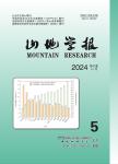
西藏帕里湖卫星遥感监测
收藏 引用
山地学报 2009年 第2期27卷 240-247页
作者: 王治华 徐起德 中国国土资源航空物探遥感中心
为查明2004年和2005年夏季在中印边界附近发生的滑坡堰塞湖溃坝灾害,采用高分辨率为主的多时相卫星图像和'数字滑坡'技术对帕里河中段从形成堰塞湖到溃坝的整个过程进行了监测。监测结果表明位于喜马拉雅山脉西段的帕里湖为高原山地萎... 详细信息
来源: 同方期刊数据库 同方期刊数据库 评论
Incremental Study Based on Support Vector Used to Anomaly Detection for Hyperspectral Imagery
Incremental Study Based on Support Vector Used to Anomaly De...
收藏 引用
2010 International Conference on remote sensing (ICRS 2010)
作者: Liyan Zhang1 Derong Chen2 Yonghua Sun1 1.Key laboratory of 3. Information Acquisition and Application of the Ministry of Education Key laboratory of Integrated Disaster Assessment and Risk Governance of the Ministry of Civil Affairs Key laboratory of Resource {3. and GIS of beijing. Capital Normal University 2. College of Mechanical and Electrical Engineering beijing Institute of Technology beijing Peoples R china
While detecting anomalies in hyperspectral imagery with support vector data description (SVDD), large numbers of operation was run because of the high dimension character of dataset and the complexity of background ... 详细信息
来源: cnki会议 评论
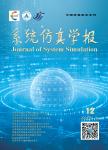
基于M进制小波的视点相关多分辨率地形模型的简化
收藏 引用
系统仿真学报 2004年 第9期16卷 1970-1973,1977页
作者: 张立强 杨崇俊 刘冬林 北京师范大学遥感科学国家重点实验室 北京100101 中国科学院遥感应用研究所 北京100101
在地形可视化领域,DEM和正射影像是主要的数据来源,它们都可看作是表示地形信息的二维信号。多进制小波是直接对标准二进制小波的综合,广泛应用于信号处理和影像压缩处理等领域。本文首先论述了多进制小波分析的原理,提出了在不同的视... 详细信息
来源: 维普期刊数据库 维普期刊数据库 同方期刊数据库 同方期刊数据库 评论
River Boundaries Extraction in Mountain Areas for SAR Images with Fusing GIS Information
River Boundaries Extraction in Mountain Areas for SAR Images...
收藏 引用
2011 CIE International Conference on Radar(RADAR 2011)
作者: Wang Xiaoliang 1 2 Li Chunsheng 2 and Wu Renbiao 1 3.1 Tianjin Key laboratory for Advanced Signal Processing Civil Aviation University of china Tianjin 3.03.0 P.R.china 2 School of Electronics and Information Engineering Beihang University {3. 100191 china 3.Defence Key laboratory for ATR Shenzhen University Shenzhen 518060 china
River boundaries extraction on SAR images is valuable for flood monitoring. Traditional methods usually failed in high relief areas. We proposed a river boundaries extraction method to conquer the difficulty to discri... 详细信息
来源: cnki会议 评论
北京平原造林后景观格局与热场环境的耦合分析
收藏 引用
应用生态学报 2018年 第11期29卷 3723-3734页
作者: 金佳莉 王成 贾宝全 中国林业科学研究院林业研究所 北京100091 国家林业局林木培育重点实验室 北京100091 国家林业局城市森林研究中心 北京100091
在人类积极的土地利用调控下(植树造林),研究景观格局变化对城乡热场环境的影响,可为今后的城市造林工程建设与优化提供参考,并为未来景观格局与热场环境的相关研究提供新视角.本研究以北京平原区百万亩造林项目为背景,运用遥感技术和... 详细信息
来源: 维普期刊数据库 维普期刊数据库 同方期刊数据库 同方期刊数据库 评论
构建数字城市的元数据服务体系
收藏 引用
计算机科学 2003年 第8期30卷 85-87,107页
作者: 王浒 李琦 董宝青 李浩川 北京大学遥感与GIS研究所数字地球工作室 北京100871 北京市信息资源管理中心 北京100088 国家信息中心 北京100053
Metadata is one of the six key technologies of digital Earth,which is also an important aspect in buildingand implementing the digital City. Based on the technologies and standards of Web Services ,the author came up ... 详细信息
来源: 维普期刊数据库 维普期刊数据库 同方期刊数据库 同方期刊数据库 评论